|
|
| home > Graphic representation |
| |
| Cartographic representations |
| |
The maps presented in this section shows the location of sampling points distributed in the classes of the attributes observed in order to provide some indication about the spatial distribution of points investigated by "National Forest Inventory".
The figures available relate to the distribution of forest area and some of its main characteristics (composition, properties, crop type, etc.)
|
| |
Type |
Dimension |
|
Distribution of sampling points classified as Forest and other wooded land area |
jpg |
14,8 kb |
|
Distribution of sampling points classified as Larch and Stone pine (Larix decidua, Pinus cembra) forest |
jpg |
12,2 kb |
|
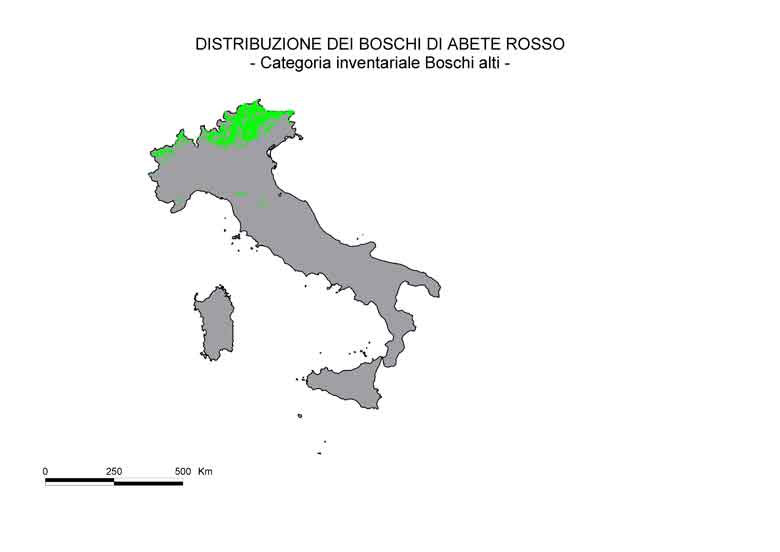
Distribution of sampling points classified as Norway spruce (Picea abies) forest |
jpg |
12,4 kb |
|
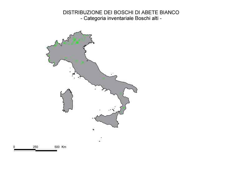
Distribution of sampling points classified as Fir (Abies.alba) forest |
jpg |
11,8 kb |
|
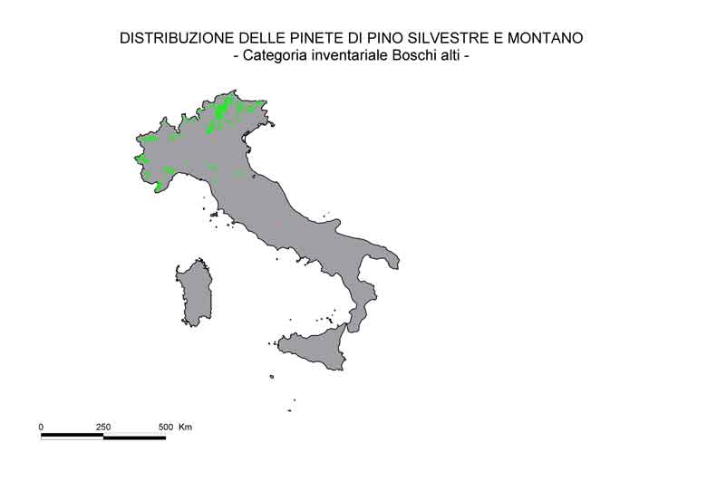
Distribution of sampling points classified as Scots pine and Mountain pine (Pinus sylvestris, P. mugo) forest |
jpg |
12,8 kb |
|
Distribution of sampling points classified as Black pines (Pinus nigra, P. laricio, P. leucodermis) forest |
jpg |
13,3 kb |
|
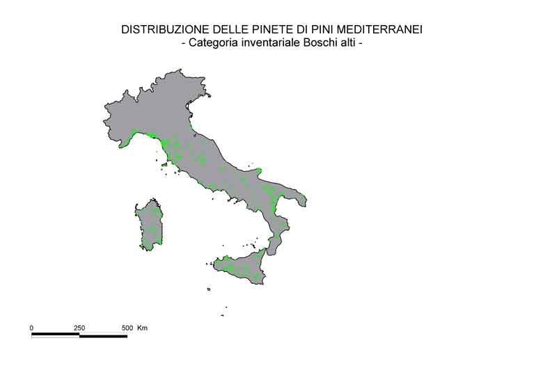
Distribution of sampling points classified as Mediterranean pines (Pinus domestica, P. marittima, P. halepensis) forest |
jpg |
12,5 kb |
|
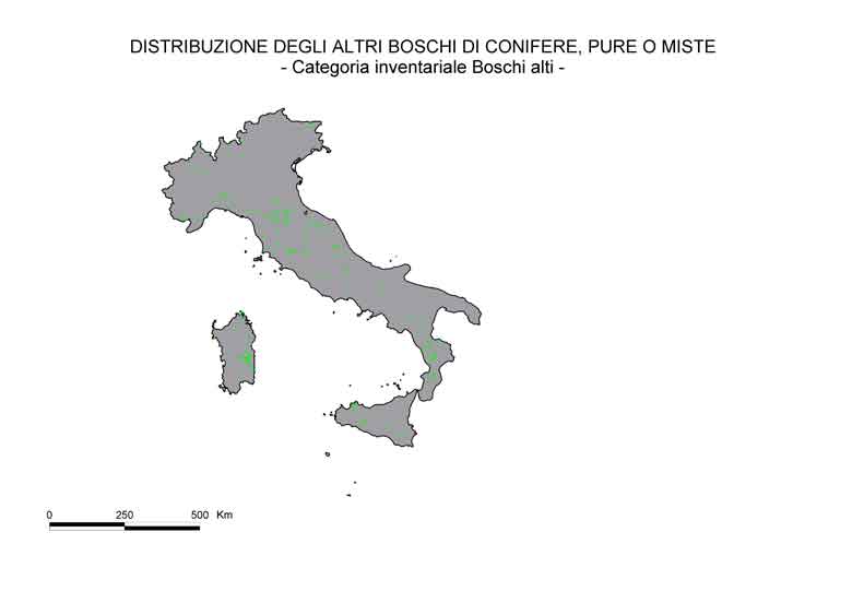
Distribution of sampling points classified as Other coniferous forests |
jpg |
12,9 kb |
|
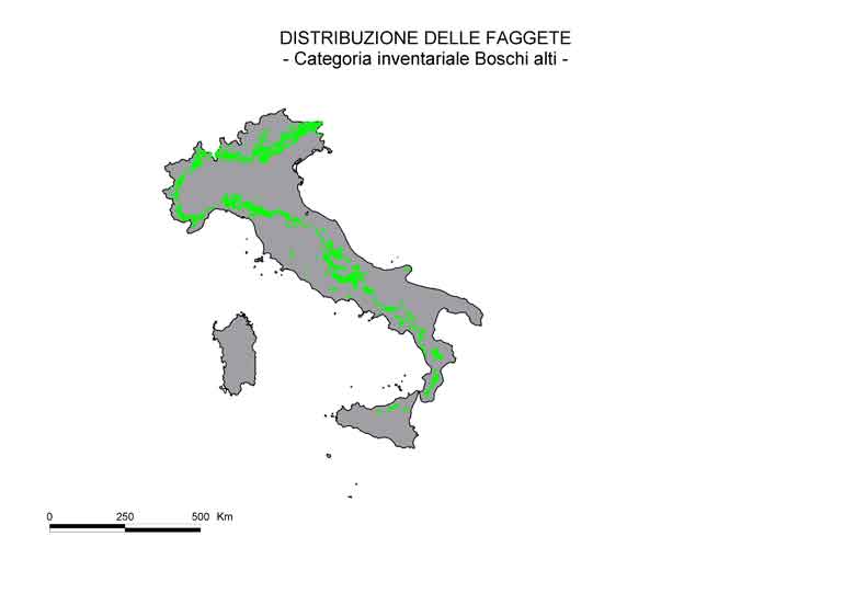
Distribution of sampling points classified as Beech (Fagus sylvatica) forest |
jpg |
12,3 kb |
|
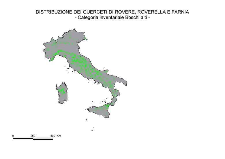
Distribution of sampling points classified as Temperate oaks (Quercus petraea, Q. pubescens, Q. robur) forest |
jpg |
13,3 kb |
|
Distribution of sampling points classified as Mediterranean oaks (Quercus cerris, Q. frainetto, Q. trojana, Q. macrolepis) forest |
jpg |
14,1 kb |
|
Distribution of sampling points classified as Chestnut (Castanea sativa) forest |
jpg |
12,2 kb |
|
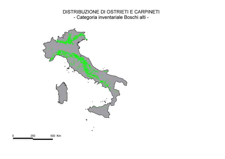
Distribution of sampling points classified as Hornbeam and Hophornbeam (Carpinus spp., Ostrya carpinifolia) forest |
jpg |
12,6 kb |
|
Distribution of sampling points classified as Hygrophilous forests (Salix spp., Populus spp.,Ulmus spp., Alnus incana) forest |
jpg |
12,3 kb |
|
Distribution of sampling points classified as Other deciduous broadleaved forests |
jpg |
13,6 kb |
|
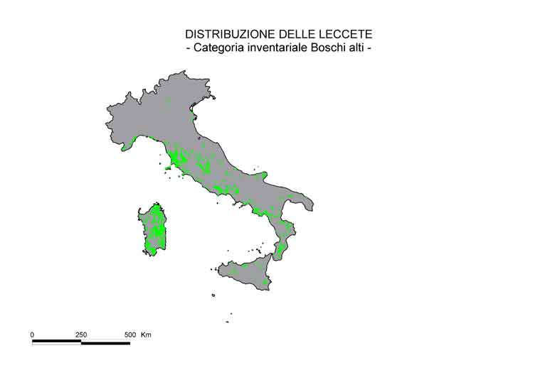
Distribution of sampling points classified as Holm oak (Quercus ilex) forest |
jpg |
11,9 kb |
|
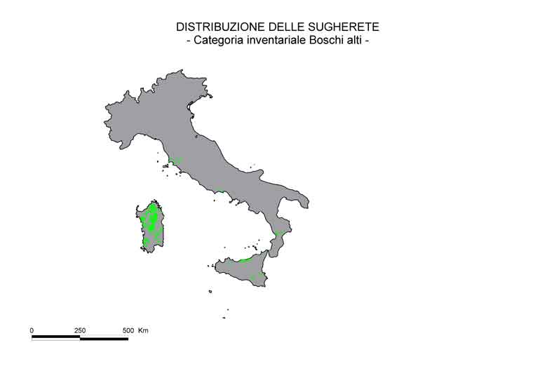
Distribution of sampling points classified as Cork oak (Quercus suber) forest |
jpg |
11,3 kb |
|
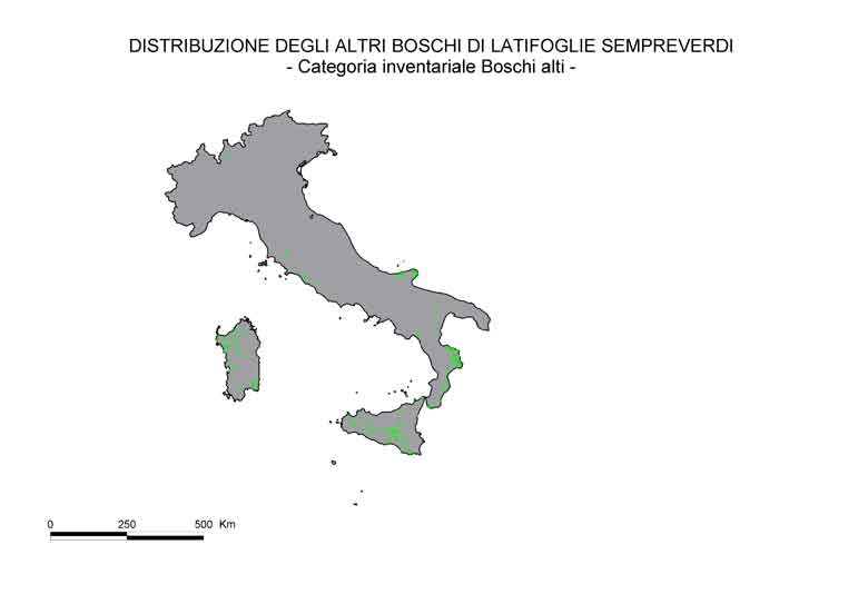
Distribution of sampling points classified as Other evergreen broadleaved forests |
jpg |
12,8 kb |
|
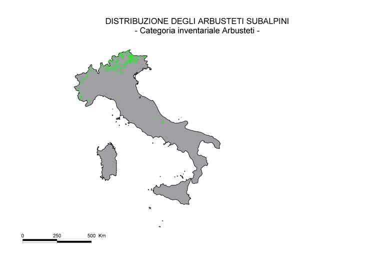
Distribution of sampling points classified as Subalpine shrubs |
jpg |
11,9 kb |
|
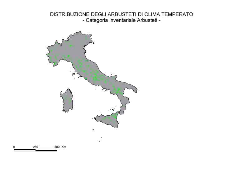
Distribution of sampling points classified as Temperate climate shrubs |
jpg |
12,8 kb |
|
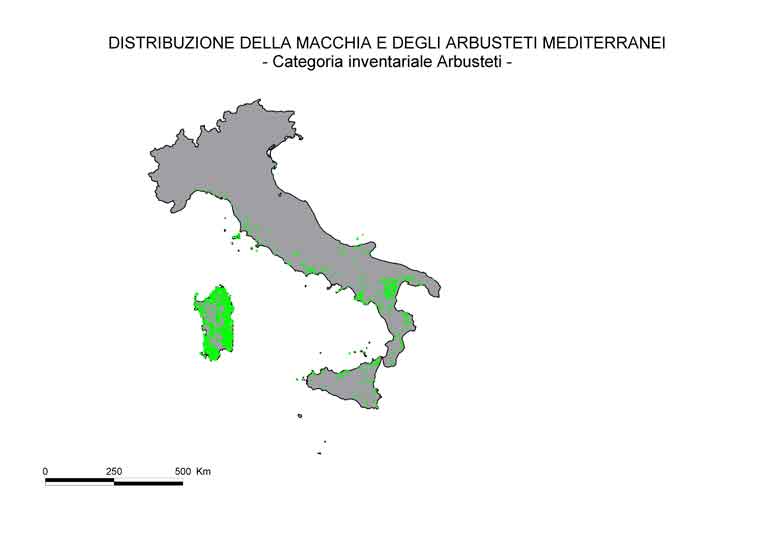
Distribution of sampling points classified as Mediterranean scrubs and shrubs |
jpg |
13,5 kb |
|
Distribution of sampling points classified by Ownership (public/private) |
jpg |
16,9 kb |
|
Distribution of sampling points classified by Presence of nature conservation restrictions |
jpg |
16,6 kb |
|
Distribution of sampling points classified by Management system (coppice/high forest) |
jpg |
15,3 kb |
|
Distribution of sampling points classified by Occurrence of slope instability and erosion |
jpg |
16,1 kb |
|
| |
|
